Friday, June 27, 2014

Extended Stay in Coarsegold, CA, Shopping in Fresno, Wildfires, and Watching Hummingbirds

Time to post a little something extra about our stay in  Coarsegold, CA.    Since our visit to Yosemite, we haven’t really been doing all that much exciting.  We were due to leave on June 23rd, but after calling ahead to a couple of campgrounds we wanted to visit, they were full and nothing was available until July 15th.  Some of that was due to the Fourth of July weekend.  We needed a good place to stay anyway, so extending our stay here at the park until July 15th was a good idea.  We have a great site, with some shade. Handy on the days that are reaching 100+ degrees, plus we have fellow RVers to visit with.   Being a fulltime RVer really give us the option of just taking our time about moving around and can relax as long as we feel like it.  We have been going to the ice cream socials on Sunday afternoons and meeting more great people.  I love the flavor of the ice cream they serve!  Umm…   We have taken a few walks but it is so hot and also with steep roads that the walks have been rather short. 

For more amusement, we have taken a few 30 mile drives to Fresno and Clovis, CA, about once a week.

 Fresno, CA  Clovis CA

The northern end of town has all the big box stores and other chain stores you find in any other good sized city.  The drive to town goes from open hills and plains to instant buildings and green grass as if somebody took a pencil a drew a line to separate the two.    So we take advantage and stock up on groceries at Wal-Mart, etc.  Doug had to see a doctor for prescription renewals and found a walk-in clinic in Fresno.  That turned out to be quite a day!  I won’t go into all of it but we waited two and a half hours before he was seen, then it took a couple of trips to Wal-Mart and back to the clinic to get everything straight!  We left our park at 10:30 AM and didn’t get home until 8:00 PM!   Just glad we were able to take care of things before being somewhere out on the road.   On the way home late in the evening, we saw a coyote close to the park.  Always a treat to see an animal like that in the wild.  Plus we stop each time at a local fruit market about half way between town and our park to stock up again on the California Bing cherries.  They are so good!  And they are good for you as well.   One nice benefit of where we are is the convenience of the Chukchansi Casino.  The dinner buffet is 2 for 1 Monday through Thursday for either $10.99 or $12.99.  Can’t beat the price for 2 people so we have been taking advantage of the special.  Yes, I played the slots just a couple of times, but when I am up to $3.00 and not winning I quit!  I hate to give somebody else my $$$!  

coyote 150px-Bing_Cherries_(USDA_ARS) Chukchansi Casino

While at home in the RV, we have been having fun feeding and watching the humming birds from our feeder we hung on the awning.  The are so cute, tiny, and colorful.  They have really been drinking that sugar water with all this hot weather.  I take most of the pictures through the window because they are so skittish.

hummingbirds at park Sierra 003 Yosemite Nat Park 002 green and red hummingbird_edited-1

This year’s drought is still so very severe.  While here in the area, there have now been 3 wildfires that were a bit too close for comfort for me!   One was 50 miles away, 35 miles away, and 60 miles away.  The first picture was the Merced fire, then route 168 fire, then the south end of Sequoia National Forest fire.  All in June.  I will be glad when we do leave this area.  Scary!  We have been near fires before in our travels and it still is very un-nerving! 

Merced fire Merced fire Sequoia forest fire

Here is a picture from a fire in the Rocky Mountains that came within 14 miles of the park outside Loveland, CO, in 2012, where we were staying.  We were so close to one fire in Las Vegas, NM, many years ago before we were RVing, that we even watched the fire come down the mountain next to the mountain where our cabin was.  Now THAT was very frightening!  Those pictures were taken with my old film camera.   The 2nd picture was taken in the Teton National Park in 2006. 

Ft. Collins, High Park fire 6-2012 006 Three Forrks and Tetons 053

Hopefully the rest of the “fire season” here in California will pass by very quietly…… So we are here relaxing and being lazy for a couple more weeks….

Saturday, June 7, 2014

Yosemite National Park and The Back Country

Lunch is packed, the bikes are loaded, alarm is set to get up early, will have a quick breakfast early in Oakhurst, then on to a day in Yosemite National Park!  We headed up to Yosemite on Wednesday, June 4.  This was our 3rd visit since 2004.  We decided to take the bikes because we discovered years ago that it is a great deal more convenient.  There are shuttle buses that take you to all the trails and overlooks.  The buses run all day but the problem is the large crowds of people which, after waiting for one bus and it arrives full, you have to wait for the next one, or the next one, or you could just walk..walk..walk…your little legs off!  It is best to arrive early, grab a parking spot, and hold on to it for the day.  There are over 4 million people who visit Yosemite each year, and the park covers an area of 747,956 acres and reaches across the western slopes of the Sierra Nevada mountain chain. Yosemite is recognized for its spectacular granite cliffs, waterfalls, clear streams, Giant Sequoia groves, and biological diversity.   Almost 95% of the park is designated wilderness.  President Abraham Lincoln signed the Yosemite Grant in 1864. Later, John Muir led a successful movement to establish a larger national park encompassing not just the valley, but surrounding mountains and forests as well - paving the way for the United States national park system.
Your first view of the park is the iconic view of Yosemite Valley.  From that height, all you see are trees, granite, and Bridal Veil Falls with El Capital to the right and half Dome in the back.  It is truly beautiful and amazing that you do not see one single spec of civilization.  Only when you actually enter the valley do you see all the tourists, traffic, shops, etc.  Also, it seems like everywhere you turn you can see a waterfall.  Due to the lack of the normal snow and rainfall this year, the waterfalls were not as heavy and pretty as we have seen them in the past.  (Most of my best pictures are in scrapbooks when I was still using a film camera.)  El Capitan is THE icon of Yosemite and the other icon of Yosemite is Half Dome (the 3rd picture).  We took the road to the top of it on our 1st visit in 2004.  At the very top, the road takes a sharp curve to the parking lot right on the edge of the cliff, no shoulder, & a straight drop down!! You can tell from the picture that is is a LONG way down!  I was petrified!!  I did not want to drive up there this trip, to the point of deciding that if Doug wanted to go bad enough, I would either wait at the bottom, or ride up lying down in the back seat! That is how scared I am of that road! Whew! Thank goodness we didn’t have time to to go up there!
  16 pan overlook attunnel end of day 1 B  Yosemite Nat Park 179
Yosemite May 2010 067
Our first stop on the way to the valley was up to the Mariposa Grove.  The attraction is a moderate hike through the Giant Sequoia trees to the ‘Grizzly Giant’, which is a giant  sequoia. It has a volume of 34,005 cubic feet making it the 25th largest giant sequoia living today.   The Mariposa Grove was first visited by non-natives in 1857 and named the it after Mariposa County, CA.  Mariposa Grove is the largest grove of sequoias in Yosemite National Park, with several hundred mature examples of the tree. Two of its trees, the Washington tree and the Grizzly Giant, are among the largest giant sequoias in the world.  Unfortunately, the Giant Grizzly was struck by lightning several years ago, and it took off a top portion of the tree.  However, I do have a film picture of the full tree from 2004.  You can see the change between the 1st picture and the 2nd one. 
  3 pan tree Grizzly Giant Yosemite Nat Park 017   
We knew we needed to be at the park early, and the evidence was clear when we left the grove.  We got to the grove at 9:00 AM and when we left the parking lot at 10:00 AM, the road up to the grove was already closed because all the parking areas were full!  This is on a weekday and early in the morning!  There was a long line of cars and a ranger was directing the cars to pull over into a lower parking area that was filling up fast.  Otherwise, I guess you have to wait in line for a ranger at the top to use their walkie-talkie to call the ranger below to tell him how many spaces had opened up in the upper parking lot. I guess people below had to wait for a shuttle to the hiking area.  The park also provides open air trams to take you on a loop through the grove but you don’t get off to visit areas.  Boy, we got to the  grove in the nick of time!  Heading on to the valley, the traffic was bumper to bumper followed by tour bus after tour bus!  Because we had been to the park 3 times already, we decided to explore the upper back country.  The road out of the valley winds up and around the side of the mountains and through the forest, with parts having drop offs with no shoulders.  You would think that after all our travels, I would be used to it by now.  NOT!!! I STILL don’t like it!  I lean into Doug as far as I can, grip the door handle tightly, look the other way,  and breathe heavily!  Only makes my hair whiter!  The forest is so pretty and green, then at the higher level, you are driving  among the granite formations.  Patches of snow adds to the beauty. Yosemite Nat Park 034Yosemite Nat Park 043 The most popular overlook on the back country drive is the Olmsted overlook, which offers a great view of the backside of Half Dome, the peak near the center of the picture.  With binoculars, you can see hikers climbing to the top and pulling themselves up the very steep 45 degree incline using chains!  Now that takes guts and maybe being just plain crazy!   I got dizzy just watching them!     6 pan back of half domeYosemite Nat Park 069 The same overlook offers a stunning view of more mountains and Tenaya Lake.  Love the blue sky, snow, and blue water!  8 pan granite & lake 2 Yosemite Nat Park 062 b  Then the road took us down to the lake and what a beautiful area!  This is where we had lunch and it was another perfect setting with stunning views!  Ah..just being outdoors and in a place like this is just fantastic!  11 pan lake 2 Yosemite Nat Park 103 Yosemite Nat Park 105 Yosemite Nat Park 101
We finished our drive at Tuolumne Meadows with panoramic views rising from the lush green meadows.  What a great drive to explore the back country!  We figured only about 1 in 10 people probably take the time to explore this area.  Most of the tourists concentrate all their time in the valley.  Just gorgeous up there!
Yosemite Nat Park 126 (2) 13 pan meadow 1Yosemite Nat Park 143
We returned to the valley and I wanted to get a picture of Upper Yosemite falls (#1) and compare it to ta picture I took in 2010 (#2).  The 2010 picture is one of my favorites.  We did have time to take a short bike ride to the Lower Yosemite Falls, which is at the bottom of the waterfall behind the trees. You can really see the difference in the level of the Merced River due to the drought.  The sun was low by the time we reached the Lower Yosemite Falls so the picture is rather dark but still a very popular trail. 
  Yosemite Nat Park 187 Yosemite May 2010 early spring Yosemite Nat Park 199
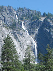
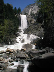
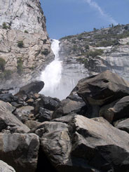
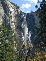
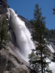
Below are some of the other waterfalls in the valley. Yosemite has the largest concentration of waterfalls in one area.  You have to hike to see Vernal and Nevada Falls but well worth it, and we did that in 2004.  The others offer a superb sight as you drive through the valley floor.  And of course, no matter where you go in the valley, El Capitan is always looming over this wonderful place as you enter and as you leave. 
Yosemite Nat Park 028 Yosemite Nat Park 178
  Sentinel Falls from near the Four Mile TrailheadNevada Fall from below and fro side, seen from Mist TrailWide Vernal Fall with Merced River in foregroundWapama Falls heads toward boulders at its baseBridalveil Fall veils the rocks over which it fallsUpper Yosemite Fall Hike
        We took the time to revisit Yosemite because we were so close by and don’t know if we will be this way again.  Gosh…just give me snow topped mountain views, waterfalls, blue skies,  and I am happy………..


Tuesday, June 3, 2014

A Drive Along the Sierra Vista Scenic Loop and Visit to Bass Lake

Off to do some fun exploring.  Yesterday, we took a 100 mile 7 hour loop drive through part of the Sierra Nevada National Scenic Byway mountains on the west side of Yosemite National Park.  It was a beautiful day for it!  Out first stop was along the south shore of Bass Lake.  It is a real popular boating and water sport area.  But with the lack of the usual heavy rain this year, the lake was really down.  Still, it is pretty nestled in the mountains. 

2 pan lake shore with Carol PE

Sierra Visata Drive 033 PE redo

Then we stopped at the North Fork Bass Lake Ranger Station for more information and maps.  We noticed that part of the loop drive we were going to take was on unpaved road.  The ranger said, “Oh, it is just fine!”  More about THAT later!!  Wonder when the last time was that he had been over that road!?  We headed up out of North Fork and were immediately disappointed at what we were seeing.  It isn’t the first time we have been fooled by fancy words.  Thank goodness, the scenery got much better as we went higher up along the switchbacks and reached the green forest.  The road was paved and 2 lanes, so not a bad ride.  The worse was yet to come!

Sierra Visata Drive 042 

We stopped at just a few overlooks but the overlooks were few and very far between.  With the forest being so tall, and the road seeming to wind forever just through trees, we were on the point of being bored.  We love scenic drives but this was not our best.  There were some great places for overlooks with great views closer to the top, but they weren’t there and no place to pull over either.  So a few pictures were taken just by stopping in the road.  In the picture below, in the lower right corner, you can see the Mammoth Pool Reservoir.  The drought has been so bad this year that it is closed to all boating and fishing.  The white area shows how low the reservoir is. 

Sierra Visata Drive 052 Sierra Visata Drive 051 Sierra Visata Drive 055

Then we reached the Mile High Vista Point at 5300’.  Wow, spectacular view!  What a spot for our picnic lunch!  We were just amazed that we had the whole scenic drive to ourselves!  This spot is surely a CA well kept secret.  It is just the getting there and out that is the hard part.  We had great views of Mount Ritter at 13, 157 ‘, Mammoth Mountain, and 15 other peaks over 10,000’.   It was just a great view with blue sky and fluffy clouds moving in and nice cool breezes.  Whew, no bears!  We just enjoyed such a peaceful lunch and took our time taking pictures. 

5 pan mile high vista 1 smaller

Sierra Visata Drive 066 Sierra Visata Drive 071

Sierra Visata Drive 072  Sierra Visata Drive 073

It was interesting how the landscape changed and we drove through some areas surrounded by granite rock formations.  Pretty in their own way. 

Sierra Visata Drive 087 Sierra Visata Drive 092 Sierra Visata Drive 107 Sierra Visata Drive 105

So far so pleasant.  Well, about 45 miles up the road from the vista overlook is where we started the dirt road we knew we were going to take.  WOW!  11 miles of winding road with dirt, rocks, washboard, or just plain deep potholes, and narrow, meaning only one way.  What a bone jarring ride!  Heaven forbid we meet somebody coming the other way! One section was just plain soft dirt with a sign that said “road work ahead”!  And when were they planning on working on this road!?  If you can call it that! More like a logging road! It was so bouncy, I couldn’t even take pictures.  Boy, the truck is dirty now!!  That ranger that told us the road was “fine” sure pulled a whopper of a white lie on us!  But the interesting part was at 7,000’.  Here is CA with a water shortage and drought, and at the upper elevation, there were many beautiful large meadows with lots of pretty green grass.  It looked so peaceful and serene.  Didn’t see any wildlife though and no places to stop.  We passed several campgrounds way up on the drive but they were all empty except for two motorhomes closer to the end of the dirt road.   I certainly would not take my rig over those roads. 

Sierra Visata Drive 099 Sierra Visata Drive 100

Whew! Glad that was over with! We reached pavement again and drove about another 30 miles to the 7,308’ summit at Cold Springs Summit.  But we were not done yet! We still had time, so we headed down to the Nelder Grove of Giant Sequoias.  ANOTHER 11 miles down ANOTHER narrow dirt, potholed road.  Are we gluttons for punishment!?    What’s that ranger’s badge number!?  We found the turnoff to the grove.  Two more miles of dirt road!  But not as bad as the other two dirt roads we were on.  The Sequoia grove turned out to be a bust.  We saw many Sequoias but not the giants that were advertised.  We reached a campground and information area and discovered we had to hike a mile into the woods to see the giants.  We were not up for the hike that late in the afternoon.  However, the picture of the tree stump indicates that it must have been a HUGE Sequoia.  The strange thing was the small 5th wheel RV Camp Host parked in the campground!  How on earth that thing got up there around the tight curves and around the trees is still a mystery to us!  Hello……nobody was home.  That was enough for us.  We headed back out, reached pavement and drove back to Oakhurst and on back to our RV. 


Sierra Visata Drive 120 8 pan tree Sierra Visata Drive 119 Sierra Visata Drive 116

Yes, we were disappointed that the drive had so few overlooks and took so long.  But you know,  that is why we are out here.  We explore, and no matter what we experience, it is all part of the adventure!   

We have taken many scenic drives that  are far above the drive we took yesterday.  We expected many more awesome views like some of the below that we found so wonderful and these are just a few scenic drives other than our views at the national parks.   Some of our favorites are: The Beartooth Mountains in Montana

beartooth pan 3To Billinings Mt Mountain Drive 071To Billinings Mt Mountain Drive 081

The Snowy Range in Wyoming

pan 2 Libby Lakepan 15 Lewis Lake edge of hikepan 13 Lake Marie 2

Mt. Evans in Denver

1 pan Evans4 pan EvansDenver Mt Evans Drive Buffalo Bill Museum 063

And so on…… I look forward to more great surprise beautiful drives this summer!